Last Updated on July 22, 2025 by Webmaster
The original source of all the data in the links is the Northern California Earthquake Data Center (NCEDC) and the ANSS Worldwide Catalogue from the Advanced National Seismic System (ANSS). The ability for us to use this data is gratefully acknowledged. All data was collected using the ANSS Catalogue Search page.
The purpose of these KMZ files is to provide a set of data coloured by depth and banded by magnitude with small dot icons to make the maps less cluttered. None of the paired files (explanation later) contain any information about the events as they are designed to be as lightweight as possible. Even so on an older computer, like mine, Google Earth can groan under the strain. You have been advised! The original files do have all the event data.
I divided the world into 4 horizontal layers each of 45 degrees of latitude and 18 vertical sections each of 20 degrees of longitude, giving a total of 72 ‘sections’.
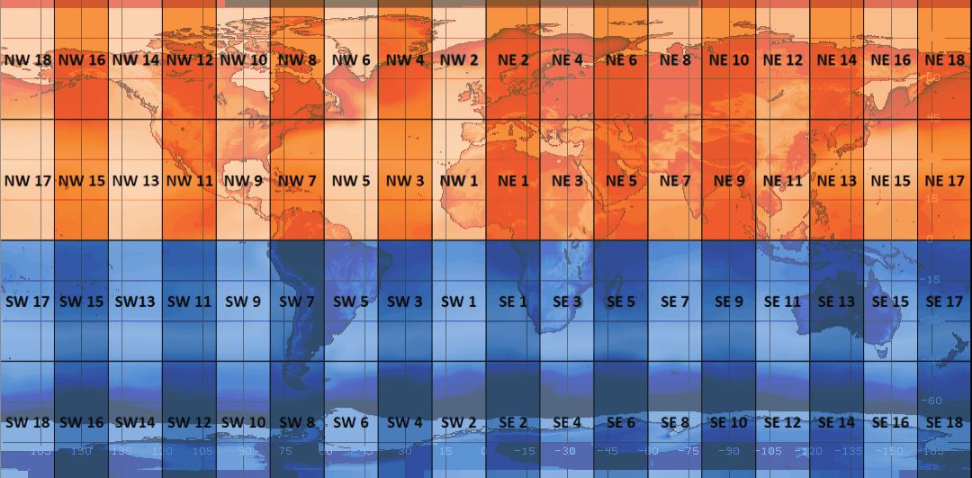
The numbering starts from Latitude 0°, Longitude 0° and goes upwards in all directions thus all the equatorial segments (0° to 45° and 0° to -45°) bear odd numbers and the polar segments all bear even numbers (45° to 90° and -45° to -90°)
The events used are all Magnitude 5+ events in the ANSS catalogue between 1898 and 2011 inclusive. This means that Magnitude 5 events are best represented from ~1973 onwards but the magnitude 6 should go back much further.
For the seismicity with smaller lighter files each equatorial and polar segment is paired for loading into Google Earth. For example the SE sections 17 and 18 are paired as SE17-18D where the D stands for depth. This results in 36 KMZ files in total covering the world.
When loaded the view is centred on the mid latitude/mid longitude of the region thus for SE17-18D this will be centred on Latitude -45°, Longitude 170°. The altitude setting is 10,000km so it is possible that for some of the less populated regions you may have to zoom in to start seeing dots before your eyes!
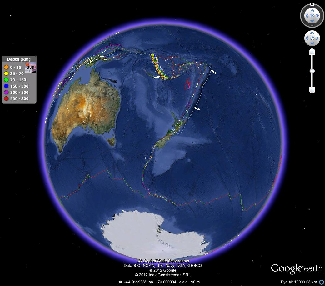
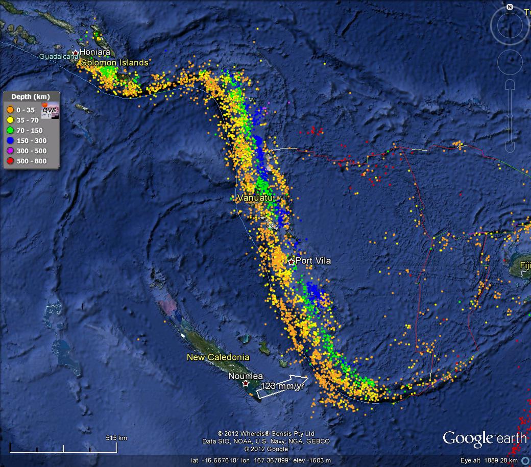
If you were to load the original components NE17 and NE18 Google earth will not display many of the events, but a little bit of zooming gives you this:
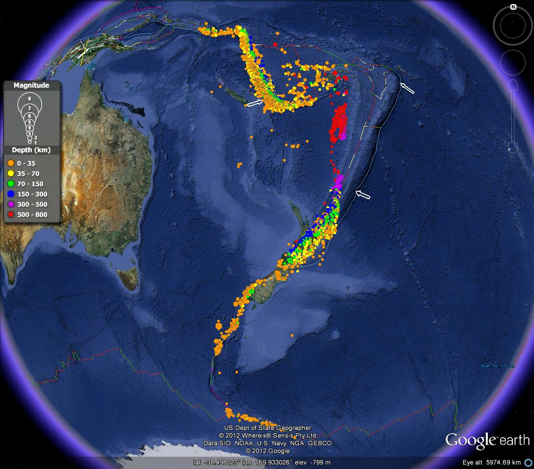
Zooming in on the Vanuatu area using the original files you can see the mass of dots obliterating the map.
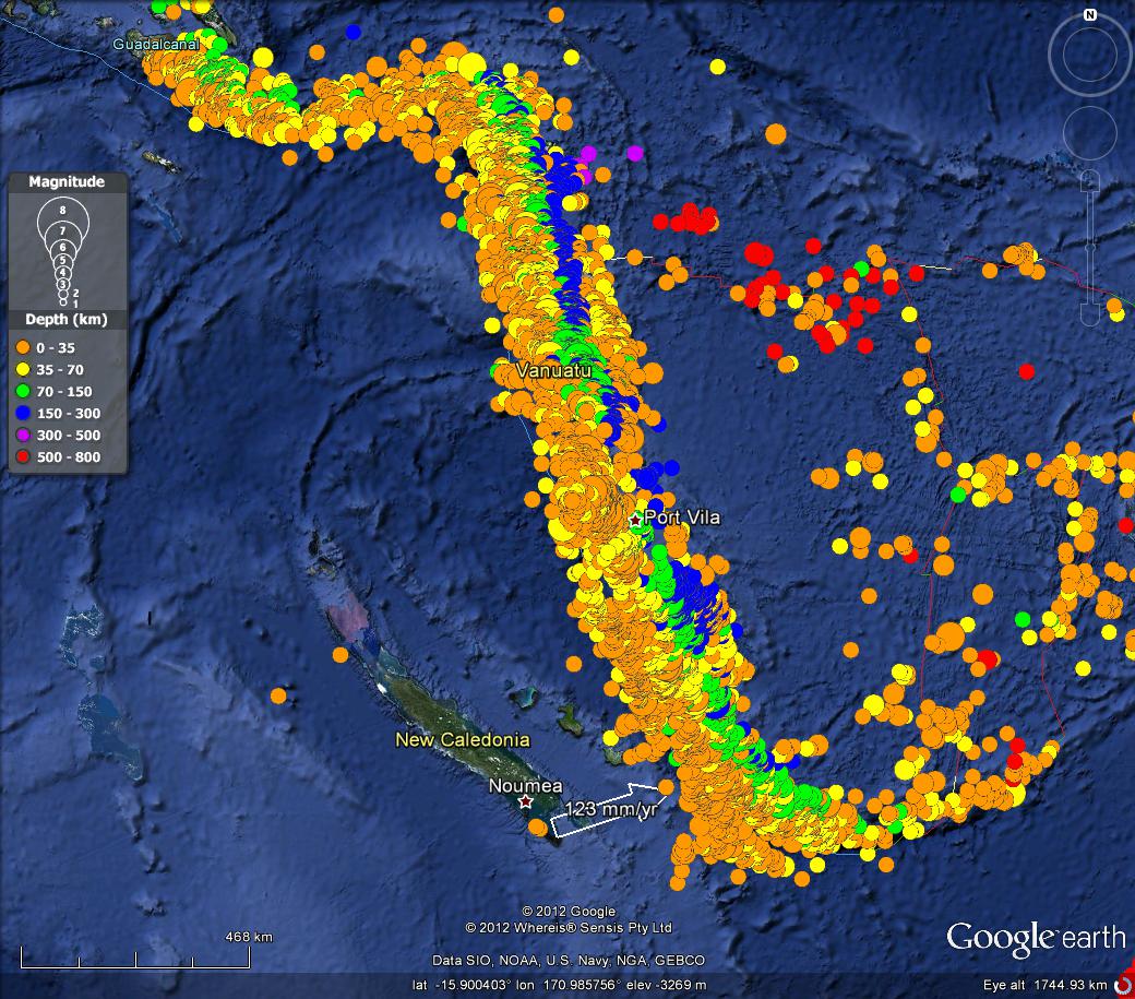
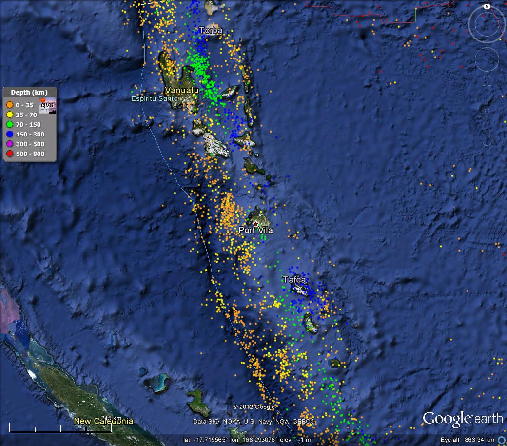
I won’t say there is much less obliteration with the smaller dots, but they do make things much easier at medium altitudes.
Centred on Port Villa at an altitude of ~860km, using the small dots, the seismicity looks like this:
By comparison here is the original version with the larger dots.
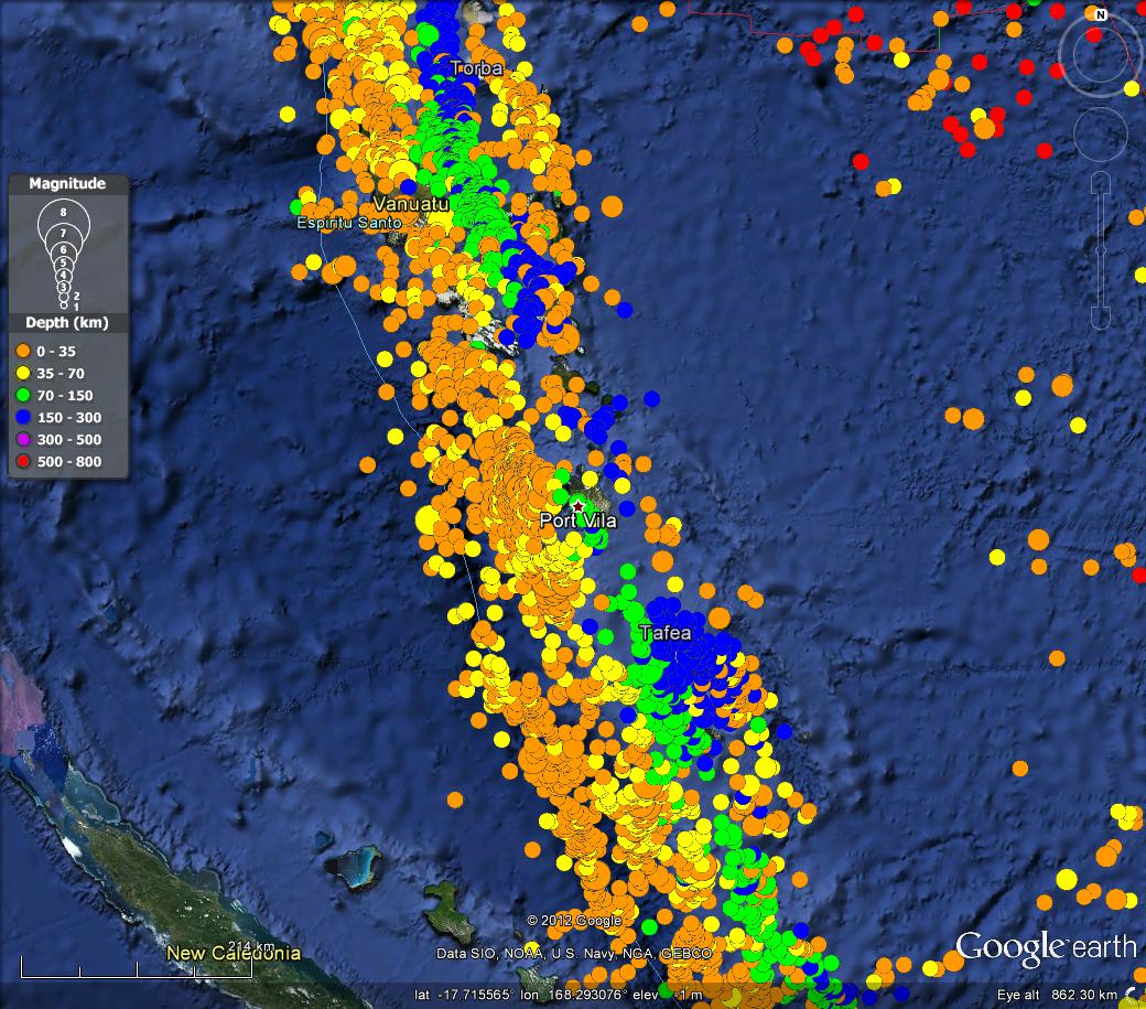
The original KMZ files do have the advantage of having the data for each earthquake event, but the disadvantage of size.
So having outlined what these are all about, here are the links to download both the 36 smaller dotted and 72 original KMZ files.
2022-09-10 Due to the length of time since I last looked at this things have changed and the KMZ files are missing. I will attempt later to re-generate these files, or a more up to date version.